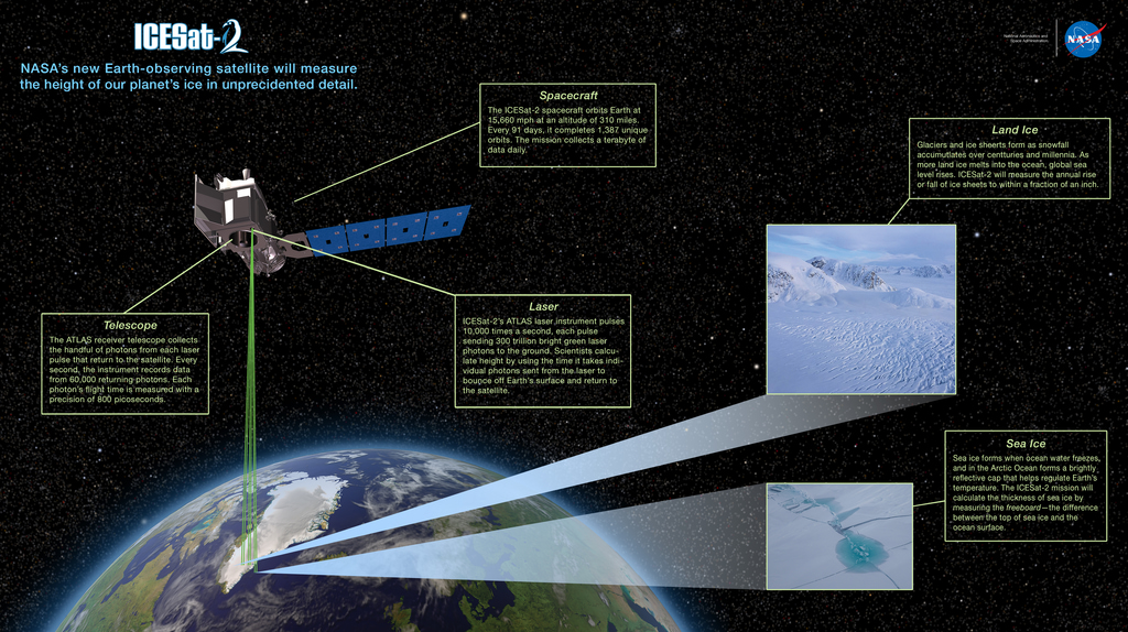


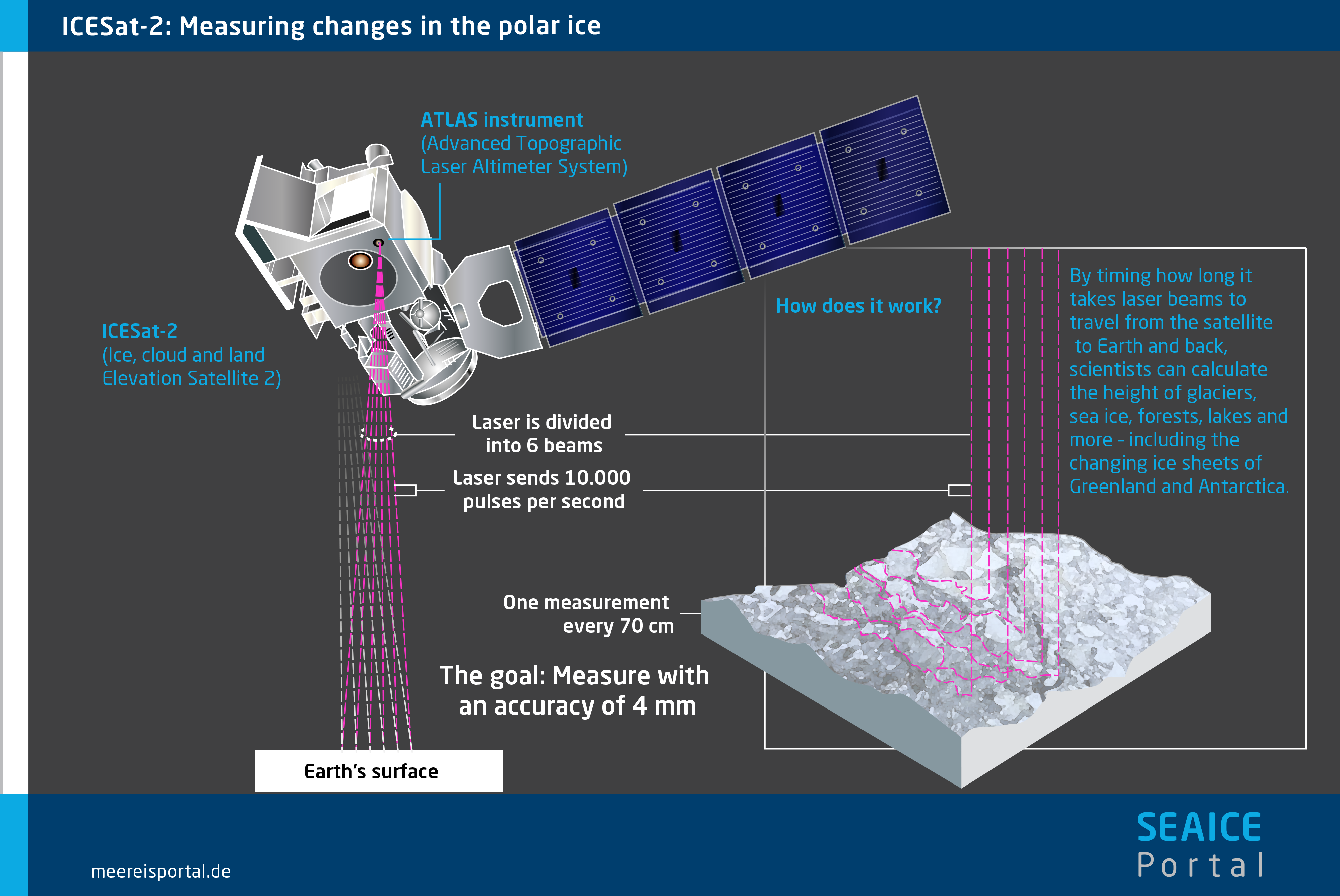
The ICESat-2 spacecraft provides power and orbit control for ATLAS, the mission's height-measuring instrument. The spacecraft supplies propulsion, navigation, attitude control, thermal control, data storage and handling, ground communication, and more.
When a goal of an Earth-observing satellite mission is to measure the elevation of ice sheets to within an inch or so, it's critical to know where in space the satellite is positioned. ICESat-2 features a novel way of situating itself in space.
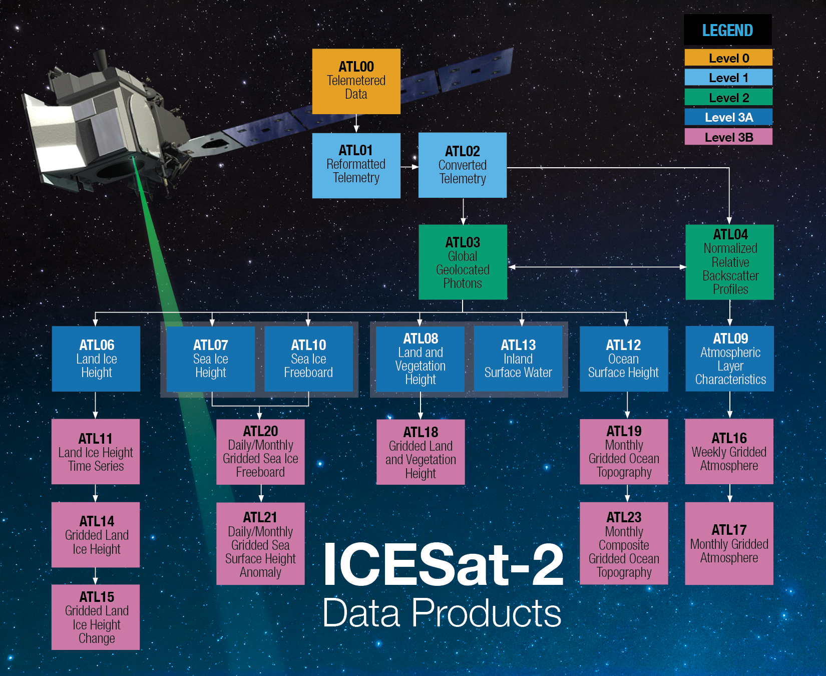
NASA ICESat-2 Mission Overview
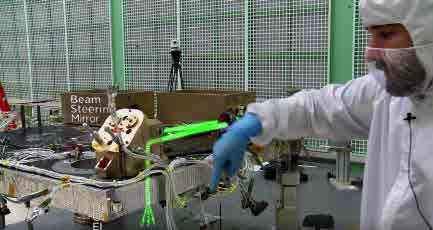
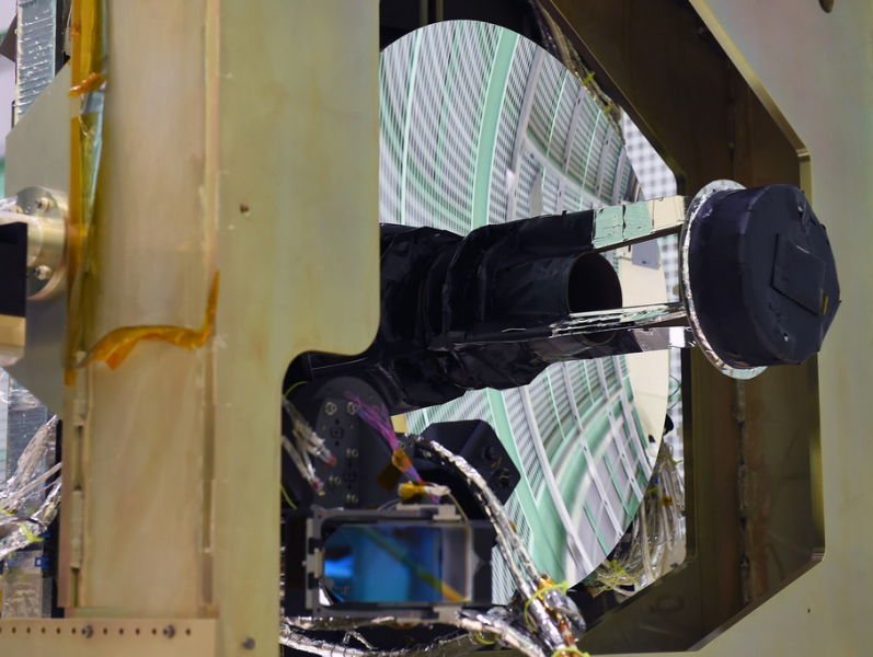
ATLAS engineer Tyler Evans points to the path of the instrument's laser beams through the Beam Steering Mechanism
The spacecraft has a GPS aboard and very specific center-of-gravity knowledge, which allow the satellite to calculate its position in space to within 16 feet. Scientists have conducted ground calibration studies and analysis to refine the positioning even further.
Knowing the spacecraft's altitude is key, since the instrument measures the distance from itself to the ground. If ATLAS is higher or lower than expected, the Earth elevation measurements will be off. ICESat-2's design enables scientists to precisely calculate its location in space and where its telescope is pointing.
ICESat-2's design enables scientists to precisely calculate its location in space
Northrop Grumman in Gilbert, Arizona built and tested the ICESat-2 spacecraft, while the ATLAS instrument was built and tested at NASA's Goddard Space Flight Center in Greenbelt, Maryland. The instrument was shipped to Arizona to be integrated with the spacecraft.
The assembled and tested ICESat-2 satellite launched from Vandenberg Air Force Base in California on September 15, 2018, aboard United Launch Alliance's Delta II rocket. It was the last Delta II rocket, which has launched more than 50 NASA science missions over its storied career.
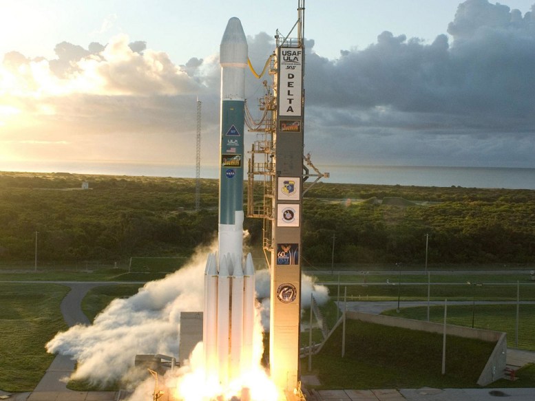
ICESat-2 launched on the final Delta II rocket